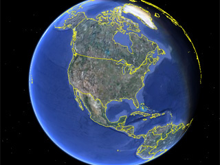
RIVERHEAD, N.Y. – A town on New York’s Long Island is using Google Earth to find backyard pools that don’t have the proper permits. The town of Riverhead has used the satellite image service to find about 250 pools whose owners never filled out the required paperwork.
Violators were told to get the permits or face hefty fines. So far about $75,000 in fees has been collected. Riverhead’s chief building inspector Leroy Barnes Jr. said the unpermitted pools were a safety concern. He said that without the required inspections there was no way to know whether the pools’ plumbing, electrical work and fencing met state and local regulations. “Pool safety has always been my concern,” Barnes said.
But some privacy advocates say the use of Google Earth to find scofflaw swimming pools reeks of Big Brother. Lillie Coney, associate director of the Electronic Privacy Information Center in Washington, D.C., said Google Earth was promoted as an aid to curious travelers but has become a tool for cash-hungry local governments.
I am beginning to hate Google. Before you gloat you might want to check your local zoning ordinance before you build little Tommy’s tree house, or Fido’s luxury dog hotel.


The Planners at Mendocino County have nothing to do so they are doing the same thing with marijuana growers who put up big (huge) houses without permits over the years. Government has nothing to do but seek new sources of funding and Google Earth is free so it is a great tool for them.
This is a big change for us. Our Planners have been sitting on their butt twiddling their thumbs for decades because we have had no recorded growth for 40 years. That does make it a good place to hide out and grow pot, but everybody is afraid our economy will collapse when they legalize it.
Eff all this.
Everyone build two pools and three tree houses, and plant a marijuana Garden. It’s time we show them the power of public opinion lets run these sheriffs of nottingham out of our lives now!!!
Do all business with no licenses, and no taxes, stop getting license plates drivers licenses registrations and inspections take all cases to court do not plea. Lets stop feeding them and bleed em dry!
#32. Want to know what retarded is? Gladly submitting to tax after tax with zero accountability.
Does this sound like you? Has the government snatched your balls away from you?
Probably never used them anyway.
Alix – “I still haven’t heard how different this is from having a private (or gov-owned) small plane from doing the very same thing.”
What makes you think I’d be on board for that? That sucks too, on a smaller scale.
Guess I have a problem with “authority”, especially as corrupt as our authorities are. Always have, always will.
37,
Then the problem isn’t he satellites, it is what the gov is doing about it.
#35 is right
This sort of activity is very common at the State and City level, I’m actually surprised they’re using Google Earth… that’s a bit bush league. The hilarious part is that this “Google” imagery is actually imagery the State of New York flew 3 years ago (notice the big “Image © New York GIS” at the bottom of the Google Earth screen). This is tax-payer funded data flown specifically purpose of planning and assessment (and for general public use, like what Google’s doing with it).
Read more about NY’s imaging program here
http://www.nysgis.state.ny.us/gateway/mg/
This will definitely help pool owners who have legally owned property. It would generate more profit those owners who are paying the right taxes.